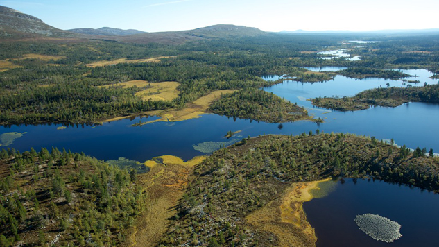
 Rogen moraine landscape. Photo: Naturcentrum AB.
What is Rogen moraine?
Look at a map over the area around Lake Rogen, and you’ll see a peculiar pattern of bow-shaped lakes and spits. It almost looks as if the ridges fit together, as if they have once been connected and then pulled apart. This mosaic is called Rogen moraine, an internationally known concept among geologists. The landform also occurs in other parts of the world, but has been named after the area around Lake Rogen as this is the type location, described by early scientists.
Rogen moraine consists of ridges that are 20–40 metres tall and 100–200 metres wide, running at a right angle to the valleys. For more than a hundred years, scientists have puzzled over how they were made. They have agreed that it happened during the ice age, but not quite how. At first it was believed that the ridges were formed at the margin of the inland ice. Later it was thought that the ridges consisted of material collected in ice crevices or between enormous melting ice blocks, so called dead ice. Today, many believe that they were formed under the enormous ice sheet as it advanced. The ice sometimes froze fast in the bedrock, pulling with it soil and stones that formed into moraine ridges.
Regardless of how they were formed, Rogen moraine ridges are very apparent to walkers. Trying to cross the ridges is like walking across a giant washboard – you feel it in your legs! Following the crests, however, is much easier. And thanks to the Rogen moraines, there are many idyllic lakes to rest by.


